


POLK, Washington County, Indiana
About
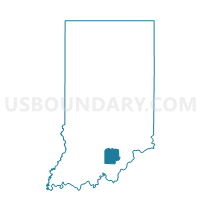
Outline

Summary
| Unique Area Identifier | 581183 |
| Name | POLK |
| County | Washington County |
| State | Indiana |
| Area (square miles) | 35.99 |
| Land Area (square miles) | 35.84 |
| Water Area (square miles) | 0.15 |
| % of Land Area | 99.59 |
| % of Water Area | 0.41 |
| Latitude of the Internal Point | 38.52781430 |
| Longtitude of the Internal Point | -85.94447070 |
Maps


Graphs
Select a template below for downloading or customizing gragh for POLK, Washington County, Indiana


Neighbors
Neighoring Voting District (by Name) Neighboring Voting District on the Map
- EAST PIERCE, Washington County, IN
- FINLEY, Scott County, IN
- FRANKLIN, Washington County, IN
- JACKSON, Washington County, IN
- MONROE 02, Clark County, IN
- WASHINGTON 1, Washington County, IN
- WOOD TWP 01, Clark County, IN
- WOOD TWP 02, Clark County, IN
Top 10 Neighboring County Subdivision (by Population) Neighboring County Subdivision on the Map
- Washington township, Washington County, IN (10,176)
- Monroe township, Clark County, IN (5,402)
- Wood township, Clark County, IN (2,747)
- Pierce township, Washington County, IN (2,666)
- Polk township, Washington County, IN (2,626)
- Franklin township, Washington County, IN (2,301)
- Jackson township, Washington County, IN (2,116)
- Finley township, Scott County, IN (1,469)
Top 10 Neighboring Place (by Population) Neighboring Place on the Map
Top 10 Neighboring Unified School District (by Population) Neighboring Unified School District on the Map
- West Clark Community Schools, IN (26,966)
- Scott County School District 2, IN (17,548)
- Salem Community Schools, IN (12,830)
- East Washington School Corporation, IN (9,709)
Top 10 Neighboring State Legislative District Lower Chamber (by Population) Neighboring State Legislative District Lower Chamber on the Map
Top 10 Neighboring State Legislative District Upper Chamber (by Population) Neighboring State Legislative District Upper Chamber on the Map
- State Senate District 45, IN (138,973)
- State Senate District 47, IN (128,339)
- State Senate District 44, IN (123,667)
Top 10 Neighboring 111th Congressional District (by Population) Neighboring 111th Congressional District on the Map
Top 10 Neighboring Census Tract (by Population) Neighboring Census Tract on the Map
- Census Tract 9677, Washington County, IN (7,303)
- Census Tract 508.01, Clark County, IN (6,199)
- Census Tract 508.03, Clark County, IN (4,899)
- Census Tract 9669, Scott County, IN (4,571)
- Census Tract 9672, Washington County, IN (4,529)